We Understand Data!
We help our clients understand qualitative and quantitative data and analyze it to fit their needs.
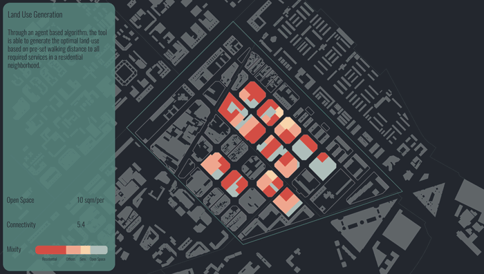
From geographic information, urban planning, demographic, historic development, infrastructure, transport and many more. We are able to visualize this data and utilize it to serve our projects. This can be anything from strategies to help urban design decisions such as zoning and distribution of built densities to human movement patterns and volumes.
We also utilize data science for Public Art projects where we use different data sets for conceptual development or creative visualization for public impact projects.


Data Gathering
Search and gather data from Online open sources
Review and collate data provided by the client and private entities.
Data Management
Review, compare and clean data sets in preparation for processing and analysis
Assist with data structuring
Compile and merge data sets where needed for ease of use


Data Analytics
Data Visualization
Perform mathematical and geometrical processing on different datasets to draw conclusions
Converting raw data into legible maps, graphs and charts to help understand different parameters
Mapping data based on geo-references